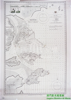
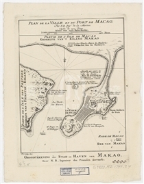
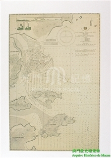
詹姆斯.库克(James Cook)是著名的英国航海家、探险家和地图师,他曾率领船队三次巡航太平洋。第三次航行,库克于1779年在与夏威夷土著的冲突中丧生,他的船队在返航途中于1780年抵达澳门,Sailing Master(William Bligh,1754-1817)对澳门及其周边航道进行了测绘,并由(William Harrison, 1750-1803)制作了本图。地图首次出版时被收录在库克船队的航海日志(A voyage to the Pacific Ocean),其后多次被不同书籍使用。地图抬头处绘有英格兰国旗、锚、舵、大炮等装饰,图中详细记录了澳门及周边氹仔、路环、大小横琴等岛屿的地理情况。值得注意的是,地图中的TYPA并非指今天的氹仔岛,而是十字门水域中由氹仔、路环和小横琴所构成的水道;澳门半岛东南以外通往广州的水道被标注为Macao Road。虽然地图名为草图,且未绘制经纬线,但精确地标出了Typa的具体位置为北纬22°9′,东经113°48′,地图的下沿画有比例尺,并在岛屿上用刻线画出地形高低,标出了航道水深、锚地、补充淡水处(watering place)和其他重要位置,显然都是经过仔细勘测后绘制的。题名之下注明了澳门航道潮汐随月相变化,满月时水位升高6英呎,5时15分在Typa、5点50分在Macao Harbour潮位最高,并在“参考(References)”中列出了航行过程中的注意事项。
本图复制自美国哈佛大学图书馆地图部所藏的单幅地图(G7822 .T27 178- .H6)。
参考文献:
[1]Cook, J., & King, J. (1784). A voyage to the Pacific Ocean: Undertaken by command of His Majesty, for making discoveries in the northern hemisphere, performed under the direction of Captains Cook, Clerke, and Gore, in the Years 1776, 1777, 1778, 1779, and 1780. London: Printed for J. Stockdale, Scratcherd and Whitaker, J. Fielding, and J. Hardy.
[2]. Kitson, A. (1907). Captain James Cook. New York, E. P. Dutton & company.
[3]. David, A., Joppien, R., Smith, B., & Australian Academy of the Humanities. (1988). The Charts & coastal views of Captain Cook's voyages. London: Hakluyt Society in association with the Australian Academy of the Humanities.

关联资料
更新日期:2019/11/15




留言
留言( 0 人参与, 0 条留言):期待您提供史料和真实故事,共同填补历史空白!(150字以内)