

")


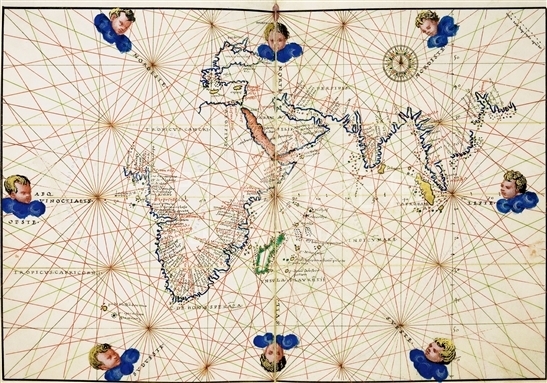
This atlas contains 14 numbered parchment sheets. In page f.11v there is the author's signature, 'Baptista agnese Ianue(n)sis fecit uenetijs/1542 die 28 Iun[j]' (Baptista Agnese from Genova, finished the work in Venice on 28 June, 1542). Baptista Agnese was a famous Genoese cartographer, but in his lifetime he did his work in Venice constantly.
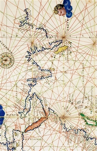
The map of the Indian Ocean (ff. 5v-6r) depicted the African coastline and the southern and eastern Asia, reaching to an uncertain location named as Agoa de pa (n) cirada. Thus the map can provide evidence of the exploration in those areas listed above. To the west of the peninsula Malacha (the place name is written in red ink) set the island of Taprobana. In spite of its name from the Ptolemaic tradition, the island could probably be identified as the island of Sumatra, for its elongated shape and its orientation along the 'north-west south-east axis'. To its southeast was a small round island (about a sixth of the area of Taprobana), whose position could coincide roughly with Java. Borneo and Celebes were completely absent from the depiction, while the Portuguese had established a base on the latter since 1525. Evidently the author had not represented the information on the map. Here was also void of the information of the archipelago of the Moluccas, which appeared as the last Asian land before approaching further to the Pacific Ocean and the western coasts of the Americas (ff. 3v, 13r) and therefore it was drawn on a position further east instead. Japanese archipelago was also absent of depiction.
Reference:
[1]. ALMAGIÀ, R. (1944). Planisferi carte nautiche e affini dal secolo XIV al XVII esistenti nella Biblioteca Vaticana. In Monumenta cartographica Vaticana (vol.1, pp.64-67, nr. 23, tavv. XXXIV-XXXV). Città del Vaticano.
[2]. ESKENASY, V. (1980). Izvoare cartografice medievale despre teritoriul românesc. Observatii pe marginea unei lucrǎri recente. Revista de istorie, 33(4), 759-766.
[3]. Biblioteca Apostolica Vaticana. (1981). Manoscritti cartografici e strumenti scientifici nella Biblioteca Vaticana, secc. XIV-XVII. Mostraorganizzata in occasione della IX Conferenza internazionale di storia della cartografia (giugno-dicembre 1981), Città del Vaticano 1981, p.36.
[4]. MUTAFIAN, C. (1999). Roma - Armenia [catalogo di mostra]. Roma, p.21.
[5]. METZEGER, W.; PROBST, V. (2002). Die humanistischen, Triviums und Reformationshandschriften der Codices Palatini latini in derVatikanischen Bibliothek (Cod. Pal. lat. 1461-1914). In Kataloge der Universitätsbibliothek Heidelberg (vol.4, pp. 297-298). Wiesbaden.
Informações relevantes
Data de atualização: 2020/09/08


Comentários
Comentários (0 participação(ões), 0 comentário(s)): agradecemos que partilhasse os seus materiais e histórias (dentro de 150 palavras).