
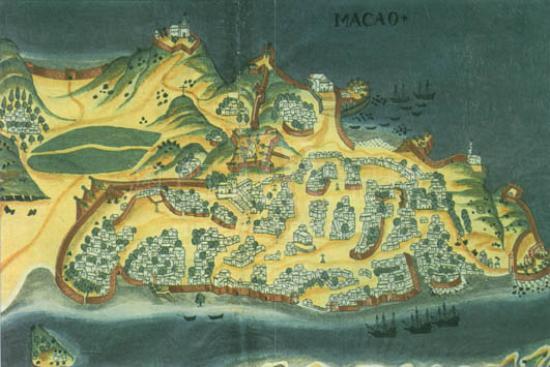



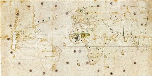
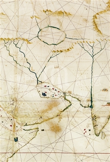
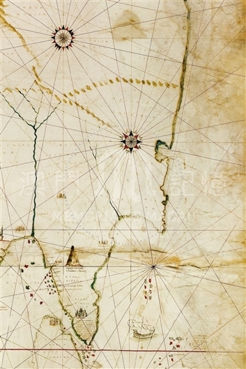
Gerolamo da Verrazano was the brother of the famous Florentine navigator Giovanni da Verrazano, who in 1524 started his voyage Westward and brought the French flag to North America. Gerolamo would accompany him in his second expedition in which Giovanni tragically died in one of the Antilles in 1528. This 1529 planisphere was one of the first two maps to show Verrazano's discoveries (the other was Vesconte de Maggiolo's 1527 map in the Ambrosian Library).
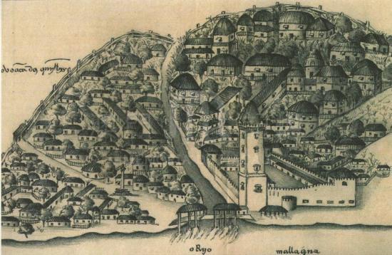
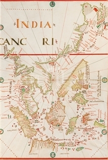
The planisphere is painted in colors on large parchments. In nautical map style, as with other contemporary maps, this planisphere represents all the known world. At the upper edge is written, 'Hyeronimus De Verrazano faciebat'. The date of the map is determined by the inscription over the three French flags on the Atlantic Coast of North America: 'Verrazana sive nova gallia quale discopri 5 anni fa giouanni da uerrazano fiorentino per ordine et Commandamento del Cristianissimo re di Francia' (Verrazana of New Gaul, which was discovered five years ago by Giovanni da Verrazzano, of Florence, by the order of the most Christian King of France). As Giovanni da Verrazano made his celebrated voyage in 1524, the accepted date of the map is therefore 1529. The contours of Asia appear complete but the delineation is conjectural for all Eastern and Northern coasts; the Southern coasts of the three peninsulae are represented with considerable care. The peninsula Indocina has a triangular form. There is a figure of Melacca, with the description: 'Questa città detta melacca è tratta di tutta la India in la quale e portoghesi tenghano una fortezza ha bonissimo porto nel qual continuo si troua assai naue indiane quale nauigano da oriente a occidente per in fine alle region del gattaio' (This city called Melacca is dealing with all India in which the Portuguese have a fortress; it has a very good harbor in which there are constantly many Indian ships which sail from East to West, and to finally the region of Cathay). The planisphere also depicts the 'Insule di Meluche' and a big island named Burnei with the description: 'in questa insula di burnei nascie de ogni sorte spetierie de oro simile et gioe in max. quantità' (in this island of Burnei there are all sorts of spices as well as gold and jewels in maximum amount). The East Coast of Asia has a protruding peninsula, which is represented in many other maps made before or at the same time. To the north of it there is a large bay with the description: 'in questo golfo di canton sta le naue che vengono dindia a queste regioni del gattaio' (in this Canton Bay, there are vessels coming from India to these regions of Cathay). The Northern Coast of Asia runs straight from East to West without names. Among the descriptions in inland Asia are 'La Cina', 'Gattaio provincial', 'Serica region', 'Tangut provincial', and 'Sinarum situs', none of which represent new knowledge.
Reference:
[1]. ALMAGIÀ, R. (1944). Planisferi, carte nautiche e affini dal secolo XIV al XVII esistenti nella Biblioteca Apostolica Vaticana. In Monumenta cartographica Vaticana (vol.1, pp.53-55). Città del Vaticano.
[2]. SIEBOLD, J. (2015). Cartographic Images. Retrieved from http://cartographic-images.net
[3]. Milano, E. (2002). I Mappamondi di Gerolamo Verrazzano e Diego Ribeiro. In Alla scoperta del mondo: l'arte della cartografia da Tolomeo aMercatore [catalogo di mostra, Modena, Biblioteca Estense Universitaria, 10 gennaio-30 aprile 2002], pp. 149-154.
Informações relevantes
Data de atualização: 2020/09/08
*Este mapa histórico destina-se exclusivamente a fins de referência académica e de investigação, não tendo qualquer validade oficial ou legal.
Comentários
Comentários (0 participação(ões), 0 comentário(s)): agradecemos que partilhasse os seus materiais e histórias (dentro de 150 palavras).